Head of Middle School Transformation @ WSS
KATRINA AXFORD
  • Home
  • About Me
  • Teaching & Learning
    • All things PBL >
      • Lead Schools Project (High Tech High)
      • PBL in Action
      • Have you had a Hamburger?
      • PBL Resources
      • Exhibtion of Learning
      • Culture of Critique
      • 2019 Teachers BDO
    • Awesome Stuff >
      • Explicit Teaching >
        • I Do, We Do, You Do
      • Positive Education >
        • VIA Character Strengths
        • Growth and Fixed Mindset
      • Flipped Learning
      • Learning Objectives and Success Criteria
      • Knowledge Organisers
      • Numeracy
      • Literacy
    • Past Schools >
      • IPACA >
        • Projects @ IPACA >
          • Year 5/6 Making
          • Year 8 Geography >
            • Jambo Kenya
          • Year 7 Geography >
            • What is Geography?
            • The World Map
            • Map Skills and Compass Directions
            • Grid References
            • Scale
            • Contours
            • Environmental Relationships >
              • Cold Environments
      • Mark Oliphant College >
        • Year 8 Visual Arts
        • Year 9 Visual Arts
        • Year 10 Visual Arts >
          • The "Making History POP" project
          • The 'Stencil Pops' Project
          • The "Putting the MO in MOC" Project
          • The 'All Art Deco Out' Project
          • The 'Art of Australia' Project
          • The Newtoon's Project
          • The "I stand by you' Project
          • My Elemental Superhero Project
          • The 'Boxing Equations' Project
          • The 'Pop ID' Project
          • The 'Lights for Civil Rights' Project
          • 'The Diggers Letter' Project
          • The 'Unruly Conflict' Project
          • The 'Could We Should We' project
          • The 'Wallz Rulz" Project
        • Year 11 Visual Arts - Traditional >
          • Visual Study
          • Practical and Folio
        • Year 11 Visual Arts - Digital
        • Year 12 Visual Arts >
          • Visual Study
          • Practical & Folio
        • Proposed Projects >
          • One Line Wonder
          • Photography >
            • Portraiture
            • Light and Shadow Project
            • Time Project
  • WSS Students
    • Year 7 Media Arts >
      • Food Struck Project
      • The 4pm Project >
        • Story board
      • Smart Starts
      • What is Media Arts
      • Technical Stuff
      • Challenge Accepted >
        • Animated Sprites and Pixel Art
        • Font-bots
        • Identity Postcard
    • Year 9 Digital Art >
      • Character Conception
      • The 'Wirri Safari' Project >
        • Howard Arkley
    • Year 8 Visual Art >
      • The 'First Fast Five' Project
      • The 'Let's Face It' Project
      • The Grid System
      • The 'Fantasy Heads' Project
      • Picasso Heads
      • The 'Paste Me Up' Project
    • Year 10 Design >
      • Graphic Design
      • What is a brief?
      • Newspaper Challenge
      • Monogram
      • Poster Design
    • Terminology
    • Media / Techniques
    • Ideas, Meanings & Themes
  • Kataxe Tube

map skills and compass directions

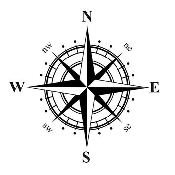
Learning objective: Investigate how we can represent information as symbols on maps.  Learn how to use the 8 points of a compass to describe direction.

Success Critieria: KNOW why we use symbols on maps, UNDERSTAND how to describe directions using the 8 points of a compass and BE ABLE TO recognise some map symbols; follow and give directions using the 8 points of the compass

MAP SKILlS

Picture
Click on Gogg to complete a interactive task about map skills
  • ​Map: A map is a simple drawing or picture of what an area of land looks like when seen from above.
  • Grid References: A gird reference is useful for identifying a place on a map.
  • Symbols and Keys: Landscape maps use symbols to give information about what the land looks like and what is on the land. A key explains what the symbols on the map are. The symbols can be pictures, words or shortened words.
  • Scale: Maps can’t show things the size they are in real life so they use scale to make things smaller. Different scales are useful for showing different amounts of detail on a map.
  • Compass: To follow directions on a map you need to know where North, South, East and West are.
  • On most maps north points towards the top of the map.
Picture
Picture
Click this button to take a quiz
Proudly powered by Weebly